Monday, April 30, 2012

Final Timeline

-August 17, 1880- Juneau City forms from Joseph Juneau, Richard Harris, and Chief Kowee's gold discovery in Silver Bowl Basin.


Richard Harris
Alaska's Digital Archives

-1890- Population 1,251, hospital, schools, 9 saloons built in Juneau

1st airplane over Juneau
UAF Archives ca. 1920

-1900- named 'seat' of government for Alaska Territory

-1913-Governor's Mansion 1st occupied


Governor's Mansion
Alaska State Library


-1920-1st airplane to fly over Juneau

-1922- Treadwell mine closes-flooded in 1917
Treadwell mine floods
Alaska State Library, VILDA, 1917

-1921-1944-Peak gold era in Alaska

-1931-Alaska Territorial Capitol Building built 
Alaska Territorial Capitol Building, present day Capitol Building
CBJ Historical Sites and Structures
-1932- Telephone system links Juneau and Nome

 -1944-last mine closed-Alaska-Juneau mine
Alaska-Juneau Mine
University of Washington Digital Collections
-1958-Alaska Statehood Act 1958-Capital Building transferred from federal government to state government

-1959-1st Alaska State Superior Court Judges sworn in=1st court system
Alaska's first Superior Court Judges
UAF Archives, ca. 1959
-1980- Juneau Centennial Committee- Juneau History Grant- money to support projects-'preserve/improve Juneau/Douglas area history'

Present- Juneau continues to have thousands upon thousands of tourists visit
Numbers for the state have slightly declined, but tourism is
still a major economical factor.


Cause and Effect Statements

The rise of the mining in Juneau greatly promoted a booming economy. Not only did the population of Juneau jump but the mining technology used during the time set standards across the world. Juneau-Douglas mining was the largest company in Alaska.

With WWII in the mix, mining operations struggled across the state of Alaska. The materials that being mined were deemed useless in the time of war. Operations became too expensive and the laborers were scarce during the war. The mines around Juneau declined from a combination of events. Some were hit with natural disasters and couldn't recover, but it came down to how much the economy changed during war times. Many jobs were lost and Juneau 'busted'.  It's hard to believe that a mine that produced $80 million in gold couldn't survive (AJ Mine, UofW libraries)  

Alaska claims statehood January 3, 1959 after President Eisenhower signs Alaska Statehood Proclamation. This leads to the development of large governing body in the capital of Juneau. 40 Representatives and 20 Senators and the governor serve the on the State Legislature.  Every January, the legislature meets in the State Capitol building. Furthermore, the governance of Alaska provides numerous jobs year after year; many are full-time, year round, others only during session.


Links 

Monday, April 16, 2012

Module IX-AK Governance & Issues

Essential Question: Pick one contemporary issue from your region and discuss - explain the issue, identify the major players and their positions.


Alaska-Juneau Gold Mine
University Libraries- University of Washington
 Upon my moving to Juneau, I heard a lot about the re-opening of the AJ Mine. I thought it would be a fitting topic for this question and become more familiar with it. First Things First Alaska Foundation introduced some brief history about the AJ Mine. It closed in 1944 because so many left for the war, and since gold had no use during these times, prices dropped. The mine was "not economically feasible to operate." Currently, prices of gold have increased to $1,651.04 per oz. (Goldprice)

Juneau residents are a major player in regards to the mine. The mine would allow for more jobs first of all. The average wage for mining in Juneau is $80,000, which is above the state's average of $40,000.  The City and Borough of Juneau could also benefit from the gains of opening the mine.  According to the FTFAF website, there is an estimated 780,000+ oz. of gold ore in the mine, which would equal over a billion dollars. the city would benefit from the taxes, amongst other things.


AJ Mine Advisory Committee (AJMAC)- This committee was created by the Mayor to weight the pros and cons of the reopening of the AJ Mine. Seven individuals composed the committee and served for 3 months beginning February 1, 2011. The committee noted some residents adamantly opposed to the mines reopening stating, "the environmental, social and economic costs are so great that under no circumstance should the borough promote any sort of industrial mining in the AJ unit." Others claim how economically beneficial the mine would be to Juneau and that environment impacts can be dealt with and eliminated ideally. The committee took a stance of "it depends" and wrote up the following recommendations:
   *underground disposal of trailings
AJ Mine ca.1936
University Libraries-University of Washington
   *underground mill operation
   *new access point to mill-minimize community
       disturbances
   *minimize surface activity- noise, light, physical
       eyesores
   *does NOT impact water system-highest  
      priority
   *protection of Gold Creek's water system
   *waste water treatment obeys Alaska's water
      quality rules
   *maximize renewable energy sources
   *enhance sustainability
   *focus on local/Alaskan employment-reach out
      to UAS, Juneau School District, for example

From what I was able to collect from their report, they did not come to a formal conclusion in regards to the mine. The biggest concern the committee saw was the needed protection of the Gold Creek water system. With prior knowledge and this high priority concern, it seemed like the majority of the committee did not support the re-opening of the AJ Mine.

Southeast Alaska Conservation Council: Against the opening of the AJ Mine. Major concern maintaining water quality. According to a recent studied, 76% of mines lack water quality control, furthermore, contaminating surrounding water sources.

Department of Fish And Game: Against the opening of the AJ Mine. Worried about the impact on wildlife.

There is so much more to this issue that I was not able to add. After doing some research, I found that  the pros and cons evidence can be very particular depending on how in depth you want to go. By just scratching the surface on this issue, I'm interested to hear about what will come of the AJ Mine in future years and listening to other's thoughts/comments.

Examine Question: Identity the Alaska Senate and House Districts in which you live. Identify the name and political party of your state senator and representative. Identify the type of local government you have. Identify the tribal government, if any, in your area, and if possible find out if it's IRA or traditional council.


1st question- Identify the Alaska Senate and House Districts. Juneau's Senate looks over District B and the House oversees District 3 & 4.


2nd question- Identify the name, political party of your senator and representative. Senator Dennis Egan is part of the democratic party as well as Representative Beth Kerttula (D), who looks over District 3. District 4 is overseen by Representative Cathy Munoz, member of the republican party.


Rep. Cathy Munoz
2012 Alaska Legislature
Sen. Dennis Egan
2012 Alaska Legislature


Rep. Beth Kerttula
2012 Alaska Legislature


3rd question- Identify the tribal government. Central Council of the Tlingit and Haida Indian Tribes of Alaska  (CCTHITA) is a traditional council representing 28,000+ Tlingit and Haida Indians. The Douglas Indian Association is a less known tribal governance in Juneau considered part of the IRA.

Evaluation:
Wow! Lot's of very useful information. As forewarned, we might not be able to read all the sources. Since this is all new information for me, it will take a while for me to understand it. For this week, however, I now have a better understanding of what the Alaska Permanent Fund and PFDs mean to Alaskans. I had always heard about it, and now I understand it better. I also found the section discussing settlement and distributions of Alaska lands interesting. There's also some good charts that break down the government system on a federal, state, to local level.

Blog Comments:
I liked Claire's blog in learning about Girdwood during WWII and how the National Guard has played a key role around the Anchorage area and even recently with lost skiers around Girdwood.

Robin's module for last week on WWII was very well written and explained. I also enjoyed her photos.

I agree with Kristin's blog overview. She not only used our readings as sources, but included personal opinions. I agree that the evacuation of Aleuts did seem more like interments and did a great job with backing up her point.


Monday, April 9, 2012

Module VIII: WWII in Alaska

Essential Questions:
Explain how Alaska's location was considered 'strategic' during World War II. What were the war activities/events that supported the perspective of 'strategic' Alaska?

Attu in proximity to Japanese base on Paramushiro
The Forgotten Theater:US submarine operations during WWII
The websites and resources provided in this week's module were phenomenal in underlining Alaska's involvement during WWII and how it was 'strategic'. The number one explanation for Alaska's importance during the war is explained by its proximity to Asia. Attu, the westernmost island on the Aleutian chain is only 650 miles away from a Japanese military base (Alaska at War). That is about 50 miles shy of a straight shot from Anchorage to Ketchikan. When putting it into perspective, that is extremely close when thinking of distance between two battling countries. With the close proximity to Asia, the United States could also reach possible allies, like Russia.

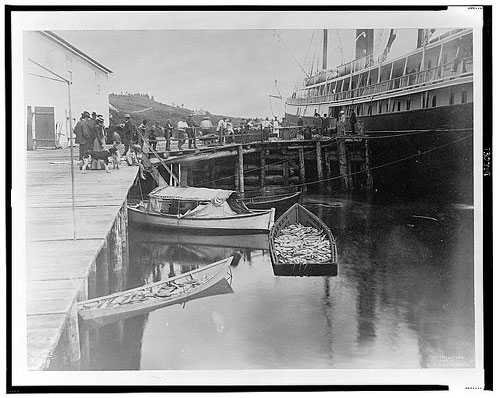
ALSIB- Alaska Siberia 1942-1945
Fairbanks, Alaska
Courtesy of Alexander Dolitsky-Alaska Siberia Research Center
Alaska was a prime example of the lend-lease program. As mentioned in the module, around 8,000 planes traveled up from the lower 48 states, skipped through Canada, and up to Alaskan military bases, such as Fairbanks. In Fairbanks, Russian pilots trained and flew the planes over the Bering Sea to help aid on the front between Germany and themselves and other locations. Resources, other than planes, were also sent oversees.

Not only did the U.S. find Alaska's location important for enhancing military positions, but so did Japan. They knew how close the islands of Attu and Kiska were and how accessible Japan would always be if they themselves didn't push east, resulting in one of the deadliest battles during the Aleutian Campaign.

The bases that were established in Alaska were described as smaller, but created diversions away from other parts of the Pacific, such as Pearl Harbor. Once in Alaska, however, it came down to survival of the fittest. Who could survive the nasty weather conditions at sea and on land? I think the U.S. used the climate as part of their strategy, even though they were greatly impacted as well.

Alaska served as a vast land that was underestimated and forgotten as part of WWII. On the AK history and culture website, Brigadier General William "Billy" Mitchell summed up the importance of Alaska.
                  [It does not take much...he who holds Alaska holds the world..]


Examine Question:
Describe the major events in the Aleutian Campaign of World War II.

-1940s- U.S. surveys Aleutians for future military base sites.
-June 1941- military numbers continue to increase, 5,500 navy in Dutch Harbor
-Spring 1942- suspecting Japanese to strike Aleutians
Japanese advancement on Aleutian Is.
Aleutian Islands, The U.S Army Campaigns
of WWII
-May 1942- U.S. Navy increases military support, sends 5 cruisers, 11 destroyers, and 36 smaller crafts to Alaska

-June 1942-bombing of Dutch Harbor, Japanese occupation of Attu and Kiska Islands
-Mid-September 1942- U.S. B-24 bombers attack Kiska
-February 1943-last air battle over Aleutian Islands
-March 1943-"Battle of the Commander (Komandorski) Islands" U.S Navy vs. Japanese ships, largest water battle during campaign
     -Japanese efforts to add supports to Kiska fail.
-May 11th-29th, 1943-U.S. attacks Japanese at Attu, by land and sea.  
      -U.S army troops caught off guard by harsh weather and climate
-July 1943- U.S 'preinvasion bombardment' on Kiska
-August 24th 1943, Aleutian Islands Campaign ended after Kiska islands declared 'secure' by Major General Charlers H. Corlett of the U.S. Army.

Capture of Attu
Aleutian Islands, The U.S. Army
Campaigns of WWII
The Aleutian Campaign stretched from 1941 up until August 1943. It stood second, behind the War of 1812, as the only time in U.S. history where another country has occupied parts of  the U.S. Upon the first signs of Japanese attacks on Dutch Harbor, Americans were ordered to evacuate the soon-to-be war zone. Many residents ended up in Southeast Alaska; 800+ estimated to have been evacuated. Homes and towns were then burned to prevent the Japanese from being able to use anything.

During the campaign, weather was another vicious enemy. Even though the military forces may be at the top of their game, too many were not prepared to withstand against freezing temperatures, debilitating winds, and treacherous seas. The battle for Attu is a prime example. Over a two week period, numbers for the U.S. and Japanese military greatly decreased. War zone fatalities played a big hand, but the extreme conditions of the Aleutians could kill the toughest men. According to the Aleutian Islands publication, the battle for Attu is considered one of the most deadliest fights in the Pacific, Iwo Jima being first.

Capture of Kiska
Aleutian Islands, The U.S. Army
Campaigns of WWII
It was interesting to read about the U.S. military's approach for taking back Kiska, seeming more like being a safe than sorry, learning experience. What I mean by this is declaring a 'preinvasion bombardment' on Kiska, releasing 424 tons of bombs and heavy fire, the U.S. military did cause the Japanese to flee. However, after hearing the Japanese had left in July, the U.S. continued on through August with the airstrikes and the original plan. Were the Japanese really gone? Rear Admiral Thomas C. Kinkaid stated the continuance as being good for training purposes and to proceed. By the time Kiska was reclaimed at the end of August 1943, it had cost $150-$170 million. I know war is very costly, and I'm curious to where this event stands in comparison to other battle/war costs in our history. I'll look it to it...

 The information I based my timeline from can be found on the Aleutian Islands U.S. Army publication or on the AHCS-Alaskans and the World website. After reading these 2 publications I found it easiest to understand all the information and compare dates in the form of a timeline.


Evaluation:
This was probably one of my favorite modules to learn about. The information and resources provided really helped provide a well informed story of Alaska's involvement during World War II. Looking at Alaska as an outsider from the lower 48, I had no idea of how the state was used by the U.S. to create a front against Japanese forces. There is so much you hear about WWII and never once have I heard anything about Alaska! I really enjoyed the photos and the maps from all the sites. As you can see I included the maps in my module because I felt these were the most informational for understanding proximity and strategies. I enjoyed reading the Aleutian Islands- U.S. Army Campaigns of WWII, World War II in Alaska  and the Alaska at War ebook. Very fun week!

Blog Comments:
I very much enjoyed reading Whitney's module VII blog. It was visually appealing and I loved her list of all the recreational activities there are in Alaska. My mom is a 5th grad teacher in Idaho and has followed the Ididarod race for years with her students. I've always wanted to watch a part of the race. Also, I love how there is so much to do in Alaska. You can never say you're bored!

I agree with Christy that it takes more than aspect to shape an area and result in settlements. Thank you for providing all those that have influenced Prince of Wales (POW) :)

Niki did a great job with her description Sheldon Jackson's role in Alaska's education system. I've heard of the museum in Sitka. I was disappointed I didn't make it there when visiting last Alaska Day. It will be on my list for next time!

Sunday, April 1, 2012

Module VII-American Period: Society

 Essential Question:
How have the settlement patterns of Alaska been a reflection of the natural landscape, distance, resources, and the economy?
Juneau Alaska, 1899
Harriman Alaska Expedition, taken by Edward S. Curtis
One of my initial reactions was how settlement along the coast seemed prominent among other areas during early exploration. Settlers were then close to main transportation routes and all resources passed by you, whether the supplies were coming or going. You were in the hub! Fishing camps and canneries speckled parts of the coast line and lumber camps open on others. As more of the Alaskan landscape was explored, settlements followed the railroads and roads that started springing up. Water systems that led deep into Alaska also allowed access to new territories and opportunities to build.

Klondike outfits near Dyea, Alaska 1898
Alaska State Library P21-11
   Once residents began to exploit the resources, bigger companies or 'big guns' caught drift of the booming economy. From there, towns continued to grow and further expanded to nearby areas. The gold rush during the late 1800s attracted thousands to Alaska. Not only did individuals flock to the mining sites, they also set camps along the supply lines. Later in the 1950's, oil sparked a new type of profitable industry. During the construction of the pipeline in the 70s, thousands more flocked to Alaska.

As mentioned by the Alaska history and cultural studies website, the U.S Army recognized the influx of inhabitants and saw the urge to return back to Alaska. Upon their return, multiple posts were established and connecting roads allowed for more developments and means of communication.

Settlement patterns greatly depend on the resources available and the natural landscapes. From there, the economy would either flourish or it would dwindle.

Examine Question:
The University of Alaska Fairbanks is the farthest north public university in the United States. What are the specialized academic areas at UAF that make it unique among American universities?

Informative sign about the center
History on the Geophysical Institute site
UAF is one of the few Land, Sea, and Space Grant universities. Students have the phenomenal opportunity of visiting the only scientific rocket launching facility, Poker Flat Research Range, owned by a university (About UAF).
Compared to other American universities, UAF has an increased affiliation with the NASA program.

Here's a list of some areas of research:
-Arctic research and arctic biology
-Geophysics and geology
-Minerals/petroleum development
-Fisheries and ocean sciences
                                                                                   -Cultural studies

Because of Alaska's vast and diverse terrain, students have the opportunity to explore all the resources that compile the land we live on, as well as understanding its multiple types of inhabitants. UAF is also the only university in Alaska that offers doctoral degrees.


Extend Question:
What are the health care services available in you community?


Here's a copy of Juneau's Community Resources, last updated January, 2012. The page includes all types of resources from housing, employment & training, to age specific support services. Here's what is listed for health & medical services:

-Adaptive Needs
-Alaska's Tobacco Quit Line
-Breast & Cervical Cancer Early Detection
-BRH-Bartlett Regional Hospital-diabetes program, emergency room, & Rainforest Recovery Center


-CCS-Catholic Community Service Hospice & Home Care
-Compass Homecare
-Community Mental Health Services
-Cornerstone Home Health & Hospice
-Family Practice Physicians
-Fetal Alcohol Syndrome Program
-Front Street Clinic/SEARHC
-HOPE-Community Resources Inc.


-JAMHI-Juneau Alliance Mental Health Inc.
-JASAP-Juneau Alcohol Safety Action Program
-NCADD-National Council on Alcoholism & Drug Dependencies
-SEAMS-South East Alaska Medical Services
-SEARHC-SouthEast Alaska Regional Health Consortium
-Southeast Medical Clinic
-Tongass Substance Screening
-Valley Medical Care


Additional services that I found fitting within this category included:
Juneau Family Birth Center
Juneau Health Center-Planned Parenthood
Wellspring Integrative Medical & Natural Birth Center


Evaluation:
I really enjoyed looking through Juneau's community database. It does a great job of consolidating a bunch of information into one location in a very easy, legible way. The most interesting section I found was about early health care and the Morningside Hospital. It's hard to believe that the first hospital for the mentally ill wasn't created until the late 1950s and those who were sentenced by the court as mentally ill and not able to take care of themselves could be sent to a hospital in Oregon. Those who left had a good chance of never returning back to Alaska. It's hard to believe that we could just send people away because of the lack of knowledge and resources available.

Blog Comments:
I really enjoyed Marg's use of pictures for supporting her blog. Also, very informative on the multiple highways that are in Alaska.

Heidi had a great explanation for all the recreational activities. There are so many and it's hard to be able to identify them all. There's such a grab bag of activities that we can be involved in by living in Alaska. I too am looking forward to the folk festival and do have the multiple skis that help conquer different terrains. Great overall explanation!

I can relate to Heather's section on how dependent my community is on air transportation. Eventhough there is the Alaska Marine Highway, it does take way too long to get from point A to point B. Thank you for linking the research to Northern Economics, Inc.


Monday, March 19, 2012

Module VI- American Period: Transportation and Communication

Essential Question:
What are issues facing Alaskans today related to transportation and communication?

Funding is critical across the board.  Whether it is from the government or down to the local level, maintenance, general upkeep, and projected development requires lots of money. It's hard to get the funding when the projected needs of transportation (highways, avaiation, AMHS) exceeds their combined revenues by $700 million dollars (Let's Get Moving 2030).  In attempt to make a profit or maintain the service, fare prices and other costs continue to increase.


U.S. Coast Guard  Cutter Healy and Russian tanker Renda
on their way to Nome.
Provided by Sara Francis/U.S. Coast Guard via Getty Images
CBS News
Additional issues lie with the climate itself. With nearly 85% of Alaska covered by permafrost, construction and building is complicated as it melts. Icefields take up an additional 4%, dense sea ice, and weather also contribute to the challenges. We all remember the Russian tanker as broke through hundreds of miles of ice to get to Nome. On land, however, the vast size of Alaska takes its toll. Major rivers and large mountain ranges make it near to impossible to connect roads and communication routes to all the villages and towns. No wonder why aviation is vital, but they have their complications too!

On a larger note, climate changes can be linked to the pollution and emissions globally. Alaska's DOT article, Let's Get Moving 2030, further breaks down the percentage released by means of transportation. Aviation leads in emissions at 67%, land travel (not including rail) 19%, and marine 13%.

I highly recommend the Alaska Department of Transportation Let's Get Moving 2030 article. It's very informative and puts things into perspective.


Examine Question:

Identify the three major railroads in Alaska history- where? when? why? ownership? current status?


1)White Pass and Yukon Railway-
Where:  Skagway to Whitehorse- approximately 110 miles long, over 90% of the rail is in Canada
Photo: John Call Benedict, engineer, stops for a photo with Steam Engine No. 5 in 1900
WY&YR facts
When: Constructed in May 1898. Finished in July 1900.
Why: To transport miners and stampeders to the Klondike gold rush and to link mines to main water sources
Ownership: Close Brothers of London sold the route to Canadian investors in 1951.   During WWII, U.S government used rail for transporting military supplies.
Current Status: In 1982, mines and WP&YR operations closed, but the railroad reopened in 1988. Today, it hosts many tourist excursions and hauls freight.

CR&NR along Abercrombie Canyon with steam shovel
John Urban Collection, 1896-1913, Vilda AMRC b64-1-150
2) Copper River and Northwestern Railway-
Where: Port in Cordova to Kennecott copper mines, approximately 196 miles long, nearly 50% on elevated structures (bridges, trestles)
When: Completed in 1911
Why: To complete a route from interior mines to open bodies of water (through Cordova). Also, shipping of mostly copper ore and some gold and silver
Ownership: Alaska Syndicate bought railroad from Michael J. Heney in 1906.
Current Status: Mine and railroad abandoned in 1938. Land and bridges donated to U.S. government for road development.

3)Alaska Railroad-
Where: Resurrection Bay in Seward to Fairbanks, freight can continue to the Ellison Air Force Base, overall 520 miles of track
When: Completed in 1923
Our trip from Anchorage to Seward on the 4th of July
via the Alaska Railroad.
Why: Route from interior mines to Gulf of Alaska. The transporting of military supplies during WWII and for construction of pipeline.
Ownership: Alaska Central Railroad Company in 1903 was bought out by a group of Canadians in 1904 until they went bankrupt. Alaska Northern Railway Company, originally Alaska Central, purchases it in 1909-1910.
Current Status: Transportation of visitors/tourists, 10 various tours, 6 schedules varying through the year, hauling of freight, up to 8 million tons according to Alaska Railroad.


Extend Question:
How adequate are the systems in your region of the state?


I think the systems in the Southeast are quite adequate. From a water perspective, the Alaska Marine Highway in this region stretches from Bellingham,Wa to Skagway, Ak. From there you can get connections to any other regions in Alaska. The one issue I see, but would be hard to alter, is the timing of arrivals and departures and the duration spent in a port. I know I've ran into problems with that before. The AMHS constantly looks for new ideas and technologies that will benefit the marine highway and its travelers. Furthermore with water travel, cruise lines bring the annual tourists that help support the port towns along the coast. The SE economy would diminish if this system was inadequate or non-existent.

Air travel in the SE and anywhere in Alaska is a prominent means of travel. Either by helicopter or by plane, this method is the quickest way to transport cargo and people in and out of the area.  One downfall is how expensive it is to fly with in the state and trying to get out, but there are many other in state flight companies that can be of aid if one doesn't work out.


Southeastern communication reminded me of how I was going to answer one of the other extend questions in regards to the capitol's location here in Juneau. I enjoyed this because I asked several colleagues on their thoughts. Across the board, everyone stated how much technology has changed and has greatly improved, allowing the governance of Alaska to be successful in Juneau. The legislature is among the many who contribute to the very impressive usage of teleconferencing. Alaskan residents can follow representatives on their personal websites, radio, television, newspapers, etc. All the information can be found online! One of my colleagues told me an interesting fact as we closed our discussion. She said that if the topic of moving Alaska's capital up North came up, she'd ask the individual if he/she participated in the local government. Too often she heard no. It makes you wonder how involved the person would be if the capitol was to be moved to a different, more central location. Just an interesting thought.

Evaluation:
One of my first accidents happened while working on this blog. Auto-save doesn't always auto-save. Lesson learned...bummer. Nonetheless, I'm really enjoying the content of this blog as well as spending the time to look at other blogs.  In relation to the content, just this last summer, my family came up to visit and we drove from Skagway to Whitehorse and then to Haines. It was a great trip, and I got to experience the variety of transportation around Alaska. I'm thankful that I live in an area that is so diverse. Even though I may have visited a glacier by boat, it's a completely different experience seeing the same glacier from an aerial perspective.  I've enjoyed getting to learn about the assorted modes of transportation: air, water, and land.

Blog Comments:
Shannon's blog is visually appealing and informative. I liked how she incorporated personal photos into her blog.

Robin had a nice presentation for her re-cap of Module V. It was easy to read and easy to access previous and new information through her hyperlinks.

Great opening photo in Joan's blog. Being new to Alaska I guess I never truly understood the dynamics of the pipeline and how it cuts through Alaska. I further liked how she tied in current events to our topics. It's very fitting since the legislature is in session.


Sunday, March 11, 2012

Module V: American Period: Alaska's Economy


Essential Question:
What have been the major components of the Alaska economy during the American period of 1867-present
Picture I took of a fishing wheel outside of Haines

Through this module we learned of the large spectrum of components that make up the Alaskan economy. Some more prevalent at the beginning of Alaska's purchase by the US, around wars, or in more present times. Each component brought revenue into the economy, but they also greatly contributed to the employment of Alaskan residents.

State of Alaska Department of Labor
and Workforce Development
Alaska History and
Cultural Studies

Water resources include the fishing market and hunting of marine animals, predominately for fur. Approximately 6 billion pounds of seafood is caught every year (Alaska Division of Economy). The Alaska Department of Fish and Game projects that seafood contributes $5.8 billion to the economy.


Expedition possibly in Sitka, 1899
Library of Congress Prints
 and Photographs Division Washington D.C.

Tourism helps the economy in several aspects. In 2008, tourism employed approximately 25,000 individuals (Knapp, 2012). According to the Alaska Office of Tourism and Development, their trend research estimated 1,532,400 visitors during the summer months of 2010.  57% of the passengers traveled by cruise ships, 38% by air, and the remaining by highway or ferry. Tourism during the summer months has been on the slight decline since a high of 1.7 million during the summers of 2007-08 (Alaska Office of Tourism and Development).


Natural Resources in Alaska includes various minerals, oil, and timber. Oil revenue contributes approximately 88% to the Alaskan economy.
Provided by the State of Alaska Commerce
Division of Economic Development

Picture I took on our trip from
 Whitehorse to Haines.
One of the most important aspects of the economy is from federal spending. In Gunnar Knapp's publication on Alaska's Economy he has great graphs that break down spending in 2008, amongst many other attributing factors. Examples included: military procurement contracts $1989 million, salaries and wages $2206 million, medical assistance programs $693 million, highway planning and construction $383 million, airport improvement program $186 million, and Indian housing block grants $80 million. If you get a chance, definitely look as his article.


Examine Question:
What were the main reasons for the American purchase of Alaska?
John Gast, American Progress (circa. 1872)


There were multiple reasons for the United States to purchase Alaska from Russia. The United States was not the only country that was initially interested in Alaska. England, France, and Spain also had potential in the race for new territory.  A main reason to venture North was through the idea of Manifest Destiny. Westward expansion of settlers in the lower 48 states had now extended North to occupy new lands and opportunities from the Russian owned Alaska and possibly territories in Canada.

In addition, the United States was also looking for backup. With the global idea of expansionism, extending influence and controls over the lands, the United States felt the pressure with their newly developed country and looked at Russia as a possible ally.

Another reason was what the land had to offer.  All 570,641 square miles of Alaska provided multiple and seemingly abundant resources.  Minerals, fish, and furs, were the predominate supply that attracted individuals to the area, some still to this day. From that, job opportunities multiplied in obtaining those resources and trading in and out of Alaska. The US would also benefit in having a shorter distance to exchange goods with, such as Asia. The Russian-American Company greatly exercised the use of large coastal trading ports and merchandise warehouses; now the US could take advantage of these establishments and commerce.

On a very far, side note, there was an additional source that I came upon which talked about multiple land purchases around 1867. I found it interesting to look at other purchases around that of Alaska's.
Virgin Islands boundary

William Henry Seward, Secretary of State, underwent negotiations with Denmark; a treaty was signed and then ratified in Denmark. The US Senate compared the $7.5 million asked price of the Virgin Islands to the $7.2 million purchase of Alaska. Land size, 133 vs. 570,641 square miles, and economic opportunities in comparison to the asked price was the deciding factor to not purchase the Virgin Islands. Virgin Islands link. The US later purchased the islands in 1916 for $25 million...(Frommer's Virgin Islands)


Evaluation:
I found this week's module very informative and somewhat more relatable since I'm affected by Alaska's economic status. It was interesting to read about all the various contributions to the Alaskan economy. I personally, liked the charts that compared the economic attributions through out Alaskan history.

Since I grew up elsewhere and recently moved to Alaska, I compared and contrasted the types of economies. I could relate to the information in regards to the lumber industry because that was the staple mark of the area I grew up in. Comparing the end product of board feet with the numbers from other areas was helpful. In 1973, Southeastern Alaskan timber produced 700,000 million board feet versus Idaho's 1.65 billion board feet in 1973. I also really enjoyed all the information on how Juneau was created around mining. I look at the geography differently now, especially when trying to picture tunnels going under the channel that I look at through my window every day. It's amazing!

Statistics for the Idaho's timber can be found at Idaho's Forest Product Industry.

Blog Comments:
I agree with Wendy that sometimes it seems like all the information can easily get jumbled together and finding a way to organize the information can help, such as the 18th century timeline she had posted. It helped me gauge and distinguish the different events.

Christy brought up a great point of how the fur industry was a major contributing factor that led to a decline in the Alaska Native culture. It's unfortunate how one thing can lead to another, and another, and another..It was a great representation of cause and effect.

I liked Lane's section where he very broke down the Creole class. In addition, the image of Spanish named areas and points of contact along the Alaskan coast helped recap their influence in Alaska.

Monday, March 5, 2012

Module IV: Russian America

Essential Question:
What is the legacy of the Russian colonization of Alaska?

The Russian's legacy in Alaska can be seen in various forms.

Iron
The introduction of new tools and technology helped with every day tasks, and introduced new ideas to adopt.  The use of larger farm animals can be beneficial in pulling larger sleighs and wagons, in comparison to the use of dogs. Iron and other metals brought to Alaska were prized for trading and making tools.


Russia left a footprint in Alaska by establishing its first library and museums, as well as introducing Russian Orthodoxy. Some of the religious books were further translated into native languages.


Russian American Company Site Sitka, AK 1805
Alaska, Russian-American Company Site,
Sitka 1805Image courtesy Alaska Library
The Russian American Company controlled the trading within Alaska's posts and internationally.The natives, however, had a trying relationship with the RAC, since they were the ones doing the hunting and trapping. Too often, prices and exchanges were unfair. Furthermore, the RAC helped gain the support needed to run the facilities in Russian America, such as schools, medical facilities, and churches.


Russian copy of the Treaty of Cession, March 30, 1867
Courtesy of the National Archives
Colonization brought many hardships to the Alaska Native groups. Diseases and illnesses swept through villages. Children were kept hostage in order to get desired results from family and/or village. Resources once readily available in areas were now meager.  Disputes between the settlers and the natives were a vicious cycle that ended with numerous deaths and destruction of ships, villages, forts, etc.

Once Russia realized that they were nearing bankruptcy and wouldn't be able protect their lands, they decided to sell.  The United States purchased Alaska for $7.2 million in 1867. Some native groups were upset with the event since it was never the Russian's land to sell.


Examine Question:
Why were Russians interested in Alaska?


A 1794 drawing of the Russian fur trading settlement on Kodiak.
Russian interest in the state of Alaska was explained by the determination of countries to expand their lands and power. Peter the Great was one of the individuals who strived for this imperialistic control, extending from parts of Europe to China's waters. Coastal ports were then able to house the construction of the ships that would travel across to explore new lands. Peter made sure to select individuals that could carry out his exploration plans after he passed in 1725.

The 1720's and early 1740s were listed as the main starting points where Russians explored Alaskan lands and crossed paths with the natives. In 1741, Georg Steller traveled as a naturalist with Vitus Bering's  expedition to Alaska. Stellar had a different approach as a naturalist, versus 'we come and we conquer'. According to the Alaska History course website, he was interested in the plants, animals, land features (ice pack), and how the various elements work together. It was interesting to learn that both the Steller Jay and Steller Sea Lion received their names through his research, among several other animals that can be seen through his link. (The Steller Sea Eagle is beautiful. I didn't know such a bird exists.)
Link

Russian-American Co Sealskin Drying Station
Alaska, Russian-American Company Sealskin Drying Station
Image courtesy Alaska Library
Other main interests included the resources available. Russian groups realized how the abundance of fury land and sea mammals could be very profitable. Pelts were traded and/or sold to other countries for big money or other resources. The Alaska Heritage mentioned how within a 56 year time frame, Russia left Alaska with about $6 million in pelts (187,000 pelts). When resources seemed so abundant, trading skyrocketed. Residents, trading posts, and other structures flocked to where the trade routes, ports, and resources were most readily available.   Unfortunately, once the resources were depleted or lacking in one area the groups would move to the next profitable site.


Extend Question:


It was really interesting reading the Russian American Reader.  I found the epidemic timeline eerie as it spans from the 1st epidemic of respiratory illnesses in 1791 to the last mentioned in the American Period, influenza and measles epidemic, where 25-50% of the population died. The reader also had a chart that separated the native population numbers into 4 geographical areas. Some numbers drastically dropped, while others greatly increased by the thousands. The site gave reasons for such fluctuations. Lastly, the documentations of communication between Alaska and Russia gives you an idea of how they perceived the exploration and their missions.

Evaluation: 
I had a little more difficulty this week because I didn't have the time I would've liked to really look over and explore additional information on the outside influences to Alaska. Lots of resources. Besides that, I did enjoy learning on this short, but significant section of history. I personally liked the Russian American Reader and its documentation examples.


Blog Comments:
Niki's blog was really easy on the eyes and to read. She did a great job with the use of photos and summing up this past week's module. I also like her used of hyperlinks back to assigned readings and to new information.

I enjoyed reading Joel's response in Module III in regards to defining culture. He brought up some very good points. I also liked reading about his experience in Toksook Bay.

I agree with Crystal's responses on culture and that there is not one thing that can define culture, it's a cluster of characteristics. Culture can be defined as broad or as narrow as we want to.